FS · Dixie National Forest
Pine Lake Campground
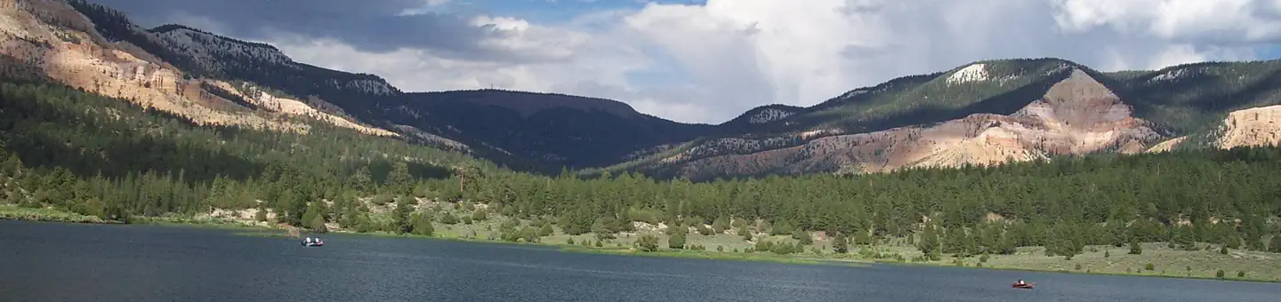
Nothing here fits 38 ft of 32 sites
- Longest for your rig
- 35 ft
- Booking
- Reservable
- Hookups
- none
- Entry
- Back-in only
- ADA sites
- —
- Elevation
- 8,203 ft
- Vehicles
- up to 15
At 8,203 ft, expect nights below freezing well into June, water systems shut off outside a short summer window, and a long climb to get here. Nothing published says when it opens — call before you tow.
Book on Recreation.gov →the official reservation system; we take no cut
Getting there
What the agency says about the road in. For a long rig this is often the binding constraint — a site that fits is no use behind four miles of shelf road — and none of it appears in the campsite data.
- Unpaved approach
A well-maintained gravel road leads to the campground, providing good access for cars and RVs alike.
quoted from the description
Every bookable site
No site here takes a 38 ft rig. The layout, for what it is worth.
Too short for 38 ft — 32 sites
01535 ft limit · back · gravel · 1 vehicle01735 ft limit · back · gravel · 1 vehicleWild Iris35 ft limit · back · paved · 15 vehiclesYellow Pine35 ft limit · back · paved · 12 vehicles00630 ft limit · back · gravel · 1 vehicle00730 ft limit · back · gravel · 1 vehicle00830 ft limit · back · gravel · 1 vehicle00930 ft limit · back · gravel · 1 vehicle01030 ft limit · back · gravel · 1 vehicle01130 ft limit · back · gravel · 1 vehicle01230 ft limit · back · gravel · 1 vehicle01330 ft limit · back · gravel · 1 vehicle01430 ft limit · back · gravel · 1 vehicle01630 ft limit · back · gravel · 1 vehicle01830 ft limit · back · gravel · 1 vehicle01930 ft limit · back · gravel · 1 vehicle02030 ft vehicle · back · gravel · 1 vehicle02130 ft limit · back · gravel · 1 vehicle02230 ft limit · back · gravel · 1 vehicle02330 ft limit · back · gravel · 1 vehicle02430 ft limit · back · gravel · 1 vehicle02530 ft limit · back · gravel · 1 vehicle02630 ft limit · back · gravel · 1 vehicle02730 ft limit · back · gravel · 1 vehicle02830 ft limit · back · gravel · 1 vehicle02930 ft limit · back · gravel · 1 vehicle03030 ft limit · back · gravel · 1 vehicle03130 ft limit · back · gravel · 1 vehicle03230 ft limit · back · gravel · 1 vehicle03330 ft limit · back · gravel · 1 vehicleClay Creek20 ft limit · back · paved · 7 vehiclesJohns Valle20 ft limit · back · gravel · 12 vehicles
Within 60 miles
| Map marker# | Campground | Distance | Sites | Longest for your rig | Hookups |
|---|---|---|---|---|---|
| 1 | North Campground (UT) | 14 mi SW | 98 | 50 ft | none · pull-through |
| 2 | Sunset Campground (UT) | 14 mi SW | 101 | 30 ft | none · pull-through |
| 3 | Barker Recreation Area | 14 mi NE | 16 | 35 ft | none |
| 4 | Kings Creek | 19 mi SW | 38 | 60 ft | none · pull-through |
| 5 | Posey Lake Campground | 20 mi NE | 21 | 35 ft | none · pull-through |
| 6 | Cowpuncher Guard Station | 24 mi NE | 1 | 30 ft | none |
Everything else on record
- Bookable sites
- 32
- Longest driveway
- 85 ft
- Max occupancy per site
- 100
- Reservable sites
- 20
- Coordinates
- 37.7456, -111.9525
- Nearest place
- CEDAR CITY
- Phone
- 801-226-3564
- Elevation
- 8,203 ft
Sources
- Recreation Information Database (RIDB) · fetched from
https://ridb.recreation.gov/api/v1/facilities/231915· retrieved 2026-08-11 · public-domain - USGS Elevation Point Query Service · fetched from
https://epqs.nationalmap.gov/v1/json· retrieved 2026-08-11 · public-domain